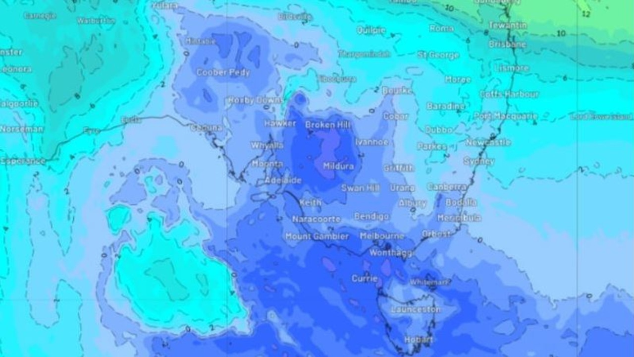
Millions of Aussies will have to suffer through almost a week of rain, after parts of the country woke up to the coldest morning so far this year.
Melburnians woke up to temperatures of zero degrees on Wednesday morning.
Residents in outer Melbourne were shivering with the mercury between –1 degrees and -3 degrees in Horsham, Bendigo, Ballarat, Geelong and the Mornington Peninsula.
However, those in the city were a little luckier with temperatures sitting just over 1 degree.
Melbourne looks set for a cold week ahead with a week-long run of mornings at or below 5 degrees.
If this happens, it will be the coldest week the city has seen in 11 years.
South Australia was also be hit with the big chill with temperatures sitting at 0.9C.
In southern Western Australia, Tasmania and the ACT, the mercury remained at single digits with widespread frost, according to the Bureau of Meteorology.
The freezing conditions are due to a combination of a cold air mass, clear skies, light winds and a strengthening high pressure system over southern Australia.
BOM said most places will get warmer from Friday.
Sydney and Darwin had the warmest temperatures, with the mercury reaching 11C and 20C respectively.
BOM senior meteorologist, Angus Hines said it will likely be a “long stretch of showery days” rather than downpours.
Sydneysiders are set for a wet week ahead with rain expected until Tuesday.
It comes after Sydney already copped up more than a year’s worth of rain in the first half of 2024.
Not much rainfall is expected in the southern parts of Australia, due to the high pressure system, but there will be a few spots to watch out for in southern parts of WA and the east coast.
An onshore flow will push through from the ocean bringing showers to southern NSW all the way up to the tropical coast of northern Queensland.
Rainfalls expected to reach between 10 to 20mm but could reach as high as 50mm.
Mr Hines said it would not be heavy, extensive, widespread or flooding rain, but intermittent spells on Thursday and Friday.
A broader area of rain will develop through central Australia, starting out in the pastoral districts and northern parts of South Australia.
Western Queensland and southern parts of the Northern Territory can expect spotty wet weather.
The system will become more significant over the weekend and into next week before it makes its way east.
https://news.google.com/rss/articles/CBMioQFodHRwczovL3d3dy5uZXdzLmNvbS5hdS90ZWNobm9sb2d5L2Vudmlyb25tZW50L3dlYXRoZXItYXVzdHJhbGlhLXZpY3RvcmlhLXNoaXZlcnMtdGhyb3VnaC1jb2xkZXN0LW1vcm5pbmctb2YtdGhlLXllYXIvbmV3cy1zdG9yeS8wYjg2NzVkM2VmYjM4YmJkNDgzNWE0YTFiOTJkMTZlMtIBAA?oc=5
2024-07-03 08:14:33Z
CBMioQFodHRwczovL3d3dy5uZXdzLmNvbS5hdS90ZWNobm9sb2d5L2Vudmlyb25tZW50L3dlYXRoZXItYXVzdHJhbGlhLXZpY3RvcmlhLXNoaXZlcnMtdGhyb3VnaC1jb2xkZXN0LW1vcm5pbmctb2YtdGhlLXllYXIvbmV3cy1zdG9yeS8wYjg2NzVkM2VmYjM4YmJkNDgzNWE0YTFiOTJkMTZlMtIBAA
Bagikan Berita Ini


0 Response to "Millions to cop days of rain, icy temps - news.com.au"
Post a Comment