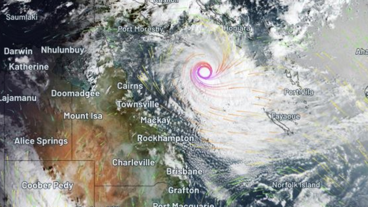
Communities in North Queensland are being warned to prepare for Tropical Cyclone Jasper to make landfall.
The Category 4 storm was about 650km east of Willis Island and 1110km east of Cairns by 11am on Saturday morning. It could make landfall by Wednesday next week.
The Bureau of Meteorology said that despite Jasper weakening overnight, it will still hit landfall as a tropical cyclone.
Authorities have warned residents to prepare immediately, with Queensland’s emergency services minister Mark Ryan putting it bluntly to reporters.
“This is not a practice, this is not a drill, this is the real deal,” he told 9News Queensland.
A Queensland Police spokesman, Shane Chelepy, urged residents to keep their cars topped up with petrol, get power packs for technology, and have enough food, water and supplies in their house to last 72 hours.
He said: “the state disaster co-ordination centre has now moved to alert”.
Although it is predicted Jasper may weaken to a category 2 by early next week, the Bureau of Meteorology has warned “there is a risk of re-intensification and the potential for severe impacts” as it nears the coast.
The latest cyclone update – on Saturday morning – was that Jasper was likely to make landfall on Wednesday between Cape Melville and Townsville, including Cairns and Cooktown.
This could put dozens of towns and cities in the danger zone.
Bureau of Meteorology spokesperson David Grant told reporters a tropical cyclone warning could be issued “as early as Sunday”, depending on the movement and development of the system.
Queensland Fire and Emergency Services Inspector David Welsh said there were a number of things people could do to prepare their properties for Jasper, including securing loose items in their backyard and checking their roofs and gutters for loose tiles.
The update comes as the Bureau of Meteorology scrambles to evacuate four meteorologists from the weather station on Willis Island in the Coral Sea, which is in danger of getting a direct hit from Jasper.
Willis Island is located 450km east of Cairns on the outer edge of the Great Barrier Reef. It is the only inhabited island in Australia’s Coral Sea Island Territory and contains a weather station, offices and accommodation, and not much else.
The station plays an important role in tracking storms like cyclones. But it could soon become the victim of one itself – but the Bureau said it would evacuate the four staff on the island “well before” Jasper arrives.
Willis Island previously saw a direct hit from the ferocious Cyclone Yasi, on February 2, 2011.
The Bureau will issue regular updates to help keep communities informed as the situation evolves over the coming days.
Communities in the region north of Mackay are advised to review their cyclone plan.
More Coverage
“We are generally expecting it to continue developing through this week, likely reaching that severe tropical cyclone category strength,” a Bureau spokesperson said.
“It is rare to see a December cyclone let alone one where we do have El Nino.
“It is unusual to be seeing this. There aren’t too many cyclones we have seen through the month of December let alone early December.”
https://news.google.com/rss/articles/CBMiyQFodHRwczovL3d3dy5uZXdzLmNvbS5hdS9uYXRpb25hbC93ZWF0aGVyL3RoaXMtaXMtdGhlLXJlYWwtZGVhbC1hdXRob3JpdGllcy13YXJuLW5vcnRoLXF1ZWVuc2xhbmQtcmVzaWRlbnRzLXRvLXByZXBhcmUtaW1tZWRpYXRlbHktZm9yLXRyb3BpY2FsLWN5Y2xvbmUtamFzcGVyL25ld3Mtc3RvcnkvODYwODAyMGI2ZDhjYjY1YWZjMmQ5NDk5MzVkODk2NjTSAQA?oc=5
2023-12-09 05:39:19Z
CBMiyQFodHRwczovL3d3dy5uZXdzLmNvbS5hdS9uYXRpb25hbC93ZWF0aGVyL3RoaXMtaXMtdGhlLXJlYWwtZGVhbC1hdXRob3JpdGllcy13YXJuLW5vcnRoLXF1ZWVuc2xhbmQtcmVzaWRlbnRzLXRvLXByZXBhcmUtaW1tZWRpYXRlbHktZm9yLXRyb3BpY2FsLWN5Y2xvbmUtamFzcGVyL25ld3Mtc3RvcnkvODYwODAyMGI2ZDhjYjY1YWZjMmQ5NDk5MzVkODk2NjTSAQA
Bagikan Berita Ini


0 Response to "‘Not a drill’: Grim cyclone warning issued - news.com.au"
Post a Comment